Feet Of Snow Possible Before Xmas
As the holiday break gets underway this weekend a powerful, slow moving winter storm will likely deliver a three-punch series of storm surges with heavy snow at times, and overall accumulations 4-5 feet possible above 7000'.
As reported Thursday by the popular Tahoe Weather Geek in a weekly email update:
"If the world ends tomorrow, we're going to miss one heck of a snow storm. A deep low pressure system moving south from the Gulf of Alaska will set up off the Pacific Northwest coast today and remain stationary through the weekend."
The National Weather Service has issued a Winter Storm Warning, in effect from early Friday through Monday afternoon. The warning predicts up to 3 feet of snow is possible below 7000' along the west side of Lake Tahoe and up to 5 feet above 7000'.
In addition to the snowfall, strong winds and gusts up to 100 mph are expected to deliver whiteout conditions at times, and contribute to 'lengthy travel delays.'
By Monday, the storm will be moving on with only residual showers, and for Christmas Day, clear skies and cold temps can be expected.
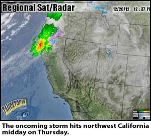
For updates, radar, and live webcams, visit www.tahoetopia.com. If you're on the road, get all the same content on the new Tahoe TV Lake Tahoe App, available for Android and iPhone.


Add comment